How Do I Avoid Claim Jumping?, Seeking the best techniques for prospecting "open" land |


 Colorado Prospector - Gem and mineral prospecting and mining forums > Prospecting, Mineral Collecting and Treasure Hunting Forums > Prospectors and Rockhounding Field Work
  |
How Do I Avoid Claim Jumping?, Seeking the best techniques for prospecting "open" land |
 Jan 25 2017, 09:34 PM Jan 25 2017, 09:34 PM
Post
#31
|
|
 Shovel Buster!  Group: Members Posts: 61 Joined: 3-January 17 From: Cleveland, OH Member No.: 124,868 |
I have no intention of trying to file a claim as I live in Ohio, but was curious on how big claims could be. Only going to be able to make it to Colorado for a few days when the kids get out of school. I am still trying to figure out the research for where claims are.
|
 |
 
|
|
Jan 26 2017, 09:42 AM
Post
#32
|
|
|
Rock Bar! Group: Members Posts: 563 Joined: 13-June 15 From: South of Gunnison in Gold Basin, Saguache County Member No.: 120,659 |
I picked up surface management maps at the blm office yesterday so I can begin my lr2000 studies haha. It's all been french to me but I think I'm getting it after seeing the maps. It makes more sense, now if I can enter the data correctly I'll be doing something!
-------------------- Level 2 member -12/25/16
Referral code JL697 |
|
|
|
|
Jan 26 2017, 06:58 PM
Post
#33
|
|
|
Rock Bar! Group: Members Posts: 563 Joined: 13-June 15 From: South of Gunnison in Gold Basin, Saguache County Member No.: 120,659 |
Mineral trespass in Colorado is a class c felony. Ouch!
-------------------- Level 2 member -12/25/16
Referral code JL697 |
|
|
|
|
Jan 26 2017, 09:45 PM
Post
#34
|
|
|
Shovel Buster! Group: Members Posts: 61 Joined: 3-January 17 From: Cleveland, OH Member No.: 124,868 |
Not going to lie, it scares the crap out of me and is very intimidating!
|
|
|
|
|
Jan 27 2017, 11:59 AM
Post
#35
|
|
 Rock Bar! Group: Members Posts: 875 Joined: 25-July 14 From: Westminster, CO Member No.: 117,949 |
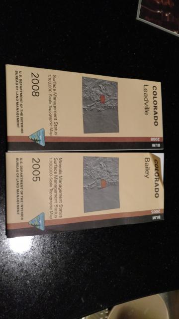
If you're looking for areas open to mineral exploration, you'll need the mineral management maps. They look the same, but mineral maps contain additional markings showing where you can explore for minerals, including if there are restrictions against types.
From their page: https://www.blm.gov/co/st/en/BLM_Resources/...m/map_info.html QUOTE A variation, the Surface and Mineral Management Map, depicts the location and nature of federally owned mineral rights in addition to surface management information.
-------------------- Lifetime Member
opera non verba "All courses of action are risky, so prudence is not in avoiding danger (it's impossible), but calculating risk and acting decisively. Make mistakes of ambition and not mistakes of sloth. Develop the strength to do bold things, not the strength to suffer." ~Niccolò Machiavelli Ref Code: EM448 |
|
|
|
|
Jan 27 2017, 01:05 PM
Post
#36
|
|
 Moderator Group: Members Posts: 4,459 Joined: 25-August 09 From: way on up thar Member No.: 6,983 |
Hmmm. I don't mean to be a Debbie Downer but I'm not familiar with those maps and have a few concerns regarding their use for confirming open land to mineral prospect, at least not using this exclusively. They apparently have some useful land status information but they can't possibly show up to the minute land status in regard to claim ownerships, don't show claim boundaries, and I'm confused as to the terminology "depicts the location and nature of federally owned mineral rights". Are they referring to 'mineral claims' in that statement? I am assuming so and not sure that they can display accurate claim boundaries, which is important. Otherwise it would seem that it's a printed version of what can be obtained on geocom. Am I wrong?
-------------------- /l ,[____], l---L-OlllllllO- ()_) ()_)--o-)_) BLACK SANDS MATTER! Very Happy CP Lifetime Member CP CORE TEAM Referral Code CE213 |
|
|
|
|
Jan 27 2017, 02:30 PM
Post
#37
|
|
 Master Mucker! Group: Members Posts: 2,430 Joined: 6-June 13 From: Falcon, CO Member No.: 82,915 |
QUOTE (swizz @ Jan 27 2017, 12:05 PM)  Hmmm. I don't mean to be a Debbie Downer but I'm not familiar with those maps and have a few concerns regarding their use for confirming open land to mineral prospect, at least not using this exclusively. They apparently have some useful land status information but they can't possibly show up to the minute land status in regard to claim ownerships, don't show claim boundaries, and I'm confused as to the terminology "depicts the location and nature of federally owned mineral rights". Are they referring to 'mineral claims' in that statement? I am assuming so and not sure that they can display accurate claim boundaries, which is important. Otherwise it would seem that it's a printed version of what can be obtained on geocom. Am I wrong? I think by "areas open to mineral exploration" he just meant it shows area where mineral exploration hasn't been withdrawn. (pointing out the difference between the surface management and mineral management maps) -------------------- Find Colorado Prospector on Facebook: https://www.facebook.com/groups/170314493176558
CP Lifetime Member |
|
|
|
|
Jan 27 2017, 03:12 PM
Post
#38
|
|
|
Moderator Group: Members Posts: 4,459 Joined: 25-August 09 From: way on up thar Member No.: 6,983 |
ah got it, thank you.

-------------------- /l ,[____], l---L-OlllllllO- ()_) ()_)--o-)_) BLACK SANDS MATTER! Very Happy CP Lifetime Member CP CORE TEAM Referral Code CE213 |
|
|
|
|
Jan 27 2017, 07:01 PM
Post
#39
|
|
|
Shovel Buster! Group: Members Posts: 61 Joined: 3-January 17 From: Cleveland, OH Member No.: 124,868 |
So those maps would show where public prospecting could happen?
|
|
|
|
|
Jan 27 2017, 08:00 PM
Post
#40
|
|
|
Master Mucker! Group: Members Posts: 2,430 Joined: 6-June 13 From: Falcon, CO Member No.: 82,915 |
QUOTE (Greenday401 @ Jan 27 2017, 06:01 PM) So those maps would show where public prospecting could happen? All they tell you is the public land open for mineral exploration, not the actual status of the land (claims) -------------------- Find Colorado Prospector on Facebook: https://www.facebook.com/groups/170314493176558
CP Lifetime Member |
|
|
|
|
Jan 27 2017, 09:26 PM
Post
#41
|
|
|
Rock Bar! Group: Members Posts: 875 Joined: 25-July 14 From: Westminster, CO Member No.: 117,949 |
Hell no those maps don't have up to the minute info; you'd be lucky to have up to the decade for some! I just looked, and 2 of mine (ordered last year) are from 2005. This is the course look, showing what general areas one can start digging further with research, LR2000, your local office and ultimately the shovel.
-------------------- Lifetime Member
opera non verba "All courses of action are risky, so prudence is not in avoiding danger (it's impossible), but calculating risk and acting decisively. Make mistakes of ambition and not mistakes of sloth. Develop the strength to do bold things, not the strength to suffer." ~Niccolò Machiavelli Ref Code: EM448 |
|
|
|
|
Jan 27 2017, 09:37 PM
Post
#42
|
||
|
Rock Bar! Group: Members Posts: 875 Joined: 25-July 14 From: Westminster, CO Member No.: 117,949 |
Towards the bottom you can see Minerals...vs Surface Management...
-------------------- Lifetime Member
opera non verba "All courses of action are risky, so prudence is not in avoiding danger (it's impossible), but calculating risk and acting decisively. Make mistakes of ambition and not mistakes of sloth. Develop the strength to do bold things, not the strength to suffer." ~Niccolò Machiavelli Ref Code: EM448 |
|
|
|
|
|
|
Jan 27 2017, 11:46 PM
Post
#43
|
|
|
Rock Bar! Group: Members Posts: 563 Joined: 13-June 15 From: South of Gunnison in Gold Basin, Saguache County Member No.: 120,659 |
As long as it's nf or blm is should be open right? Especially if there are other claims around. Wilderness and Natl parks and monuments and all that are clearly marked on my other maps.
-------------------- Level 2 member -12/25/16
Referral code JL697 |
|
|
|
|
Jan 28 2017, 10:05 AM
Post
#44
|
|
|
Rock Bar! Group: Members Posts: 875 Joined: 25-July 14 From: Westminster, CO Member No.: 117,949 |
That's a decent rule of thumb, but it's not always true. For instance if you have the Estes mineral map, you can see Fairview peak and west of North Sheep Mountain aren't open to exploration (no vertical line markings), despite being managed by the FS with lands open to exploration around them both. Keep in mind, this map is also from 2010; if I were interested in those two areas, I would research further to see what the specific situation is there for mining.
-------------------- Lifetime Member
opera non verba "All courses of action are risky, so prudence is not in avoiding danger (it's impossible), but calculating risk and acting decisively. Make mistakes of ambition and not mistakes of sloth. Develop the strength to do bold things, not the strength to suffer." ~Niccolò Machiavelli Ref Code: EM448 |
|
|
|
|
Jan 28 2017, 11:00 AM
Post
#45
|
|
|
Rock Bar! Group: Members Posts: 563 Joined: 13-June 15 From: South of Gunnison in Gold Basin, Saguache County Member No.: 120,659 |
We hiked in to fairview lake and mountain last summer a few times and I camped there too. It's a thick forest up there and a good hike up. I found some gold up there at one of the confluences down from the lake but need to do more testing. There are also terminal moraines just down from the lake that need tested but my wife almost poked her eye out with a tree branch so I didn't really get time. The parallel gulches have the same moraines. There are a few faults up there that interest me and I'll be back up there this summer as well as other places in that area to look at. It takes so much time to do this work but it's my favorite part of it. There is probably a vein up there still.
Sheep mtn I believe is in fossil ridge wilderness but fairview is in the wilderness recreation area. Wilderness recreation isn't closed to claims but the wilderness area itself is. They can both be prospected for gold but limited opportunity to stake a claim. It's fine to dig and prospect either way. If you're ever interested in spending time up there I'd go with you. It's a big area but Ive learned some of it. There's an old cabin out there we found last summer in a gulch nearby. The tin cans we found there were all the old pre1887 style with the cap and seal solder work and the soldered side seam. I'd like to detect it sometime when I'm up there. I will be spending all my free time up there this summer. We saw 6 moose up there in one day. -------------------- Level 2 member -12/25/16
Referral code JL697 |
|
|
|
|
| Lo-Fi Version | Time is now: 2nd May 2025 - 08:23 AM |