Printable Version of Topic
Click here to view this topic in its original format
Colorado Prospector - Gem and mineral prospecting and mining forums _ Prospectors and Rockhounding Field Work _ Mt. Antero
Posted by: amethystguy Jul 28 2009, 10:31 AM
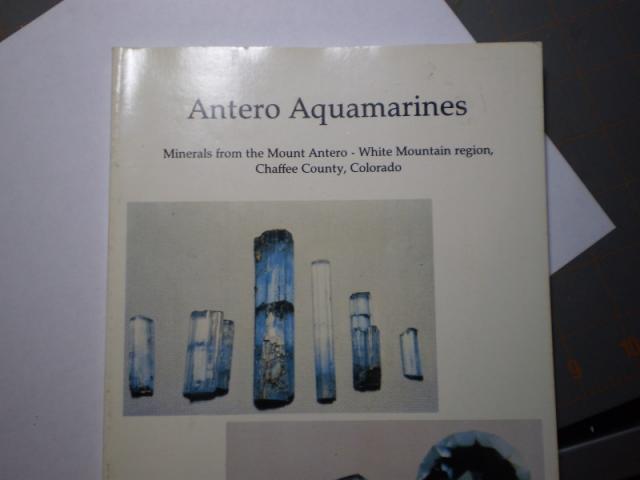
Hey guys long time no see..CP and Mrs. CP...as I was in the mtns. of North carolina this last weekend I went to a mineral museum which had lost of books...now 90% of all rock and min. books just repeat the same thing..so they get nary a glance from me...well this time I noticed one book way in the back in the corner.."whats this" I say..."golly gosh darn lookie here" ...looks like a Bible but not just any old bible the "Mt. Antero Bible"(comparing this find to something as good as the Bible:)) well heck ya..this is an awesome book..extremely in-depth..well written..all the info you could ever need..it's older written in the 80's but still an excellent read...what is the collecting status on Antero and White mtns. now? Are there still large lode claims filed on those molybdenum areas? any other info you can provide?
|
|
|
|
Posted by: ColoradoProspector Jul 28 2009, 02:21 PM
Hi Amethystguy,
Very cool book you got ahold of there.  Keep that one around for sure.
I would imagine that yes, there are still many active claims up there for many different goodies found in that area. Active claims have been in use up there since the late 1800's.
Way up in altitude and very very steep conditions, be prepared for any weather any time of the year too.
After some good research as to claims and locals, I bet one could find a spot to prospect on up there though.  Just make sure not to accidentally be on someones claim(s).....they might get a tad irratated.
Oh yea, go slow, pace yourself and remember to breathe .......it's very high altitude. 
CP
Posted by: amethystguy Jul 28 2009, 07:42 PM
Hey CP are the claim laws still the same as they were 20 years ago. Do all the claims have to be staked and/or marked? Is it still true that the claim has to be worked every year for a certain amount of time or by some certain degree? Do they still have to file a yearly affidavit of assement work? I can challenge the validity of a claim if no actual work has been done and documented, correct? Also is the FBLM still in Lakewood? Hypothetically speaking if a claim is not staked or marked or with rock monuments and you are hiking across a claimed piece of property and you happen to spot something like a crystal or whatever and pick it up are you liable for "mining" on someones claim even if no markings or claim posts are seen? Sorry about all the questions but when it comes to mlegality and claims this is the number one site to go to...Thanks CP
Posted by: russau Jul 29 2009, 06:46 AM
i beleive the laws are still the same as any other federal mining claim. the monuments/signs keep getting destroyed by jerks or natural events(rock slides) and yes you could be violating a mans claim if still a valid one by picking up minerals from his claim.and yes they need to do their assessment work to keep it valid. do your research before you pickup anything.and id have a copy of it on you when you go out and your GPS so you know where your at to backup your information. there was a show on tv awhile back about these claims up there.
Posted by: ColoradoProspector Jul 29 2009, 10:19 AM
You are very welcome Amethystguy, and thank you for the very kind compliments. That is what we strive for here.
As Russ said, the mining laws are the same as 20 years ago and the basics of "staking" and "monumenting" claims are still required.
Yes all location claims must be marked with corner monuments and discovery markers by federal law. There aren't any laws stating they must be re-erected if something happens to them though either. Like Russ said.....things happen and they do get knocked down.
The requirement for locations claims to have assesment work is still true today too although I don't think a citizen can challenge a claims validity.....that authority is the BLM's if I'm not mistaken. The waiver can only be used for claim owners with less than 10 claims to.
Yepper, BLM office is still in Lakewood.
On your hypothetical situation........technically you would be committing "mineral tresspass" which is a class c felony. Easiest way to describe our responsibility and avoid that situation in the field is ....it's our job as prospectors/field collectors to know where we are and where not to be. Location claims and patented claims (private land) are often mistaken for open ground just because it's not marked or fenced off, or the markers weren't seen.
But it't still our job personally to know where we are in field. Patented claims are privately owned lands.
Location claims are still usable for other activities but you can not prospect on them and your activities can not interfere with any mining operations.
Best if you wish to prospect a bit, do a little pre checking and make sure you're going to an open spot.
Hopefully this helps out with some of the q's
We also strive to help club members learn the ins and outs along the way while doing all these steps in research and all the questions that arise too.  If you or other readers are really interested in learning about claims, filing and the research involved, check out the http://www.coloradoprospector.com/membership.html page sometime.
CP
Posted by: amethystguy Jul 29 2009, 11:22 AM
Cool..thanks guys..clears some things up...I knew that it was the prospectors job to know where he was at at all times..i just didn't know if you could get into trouble if you happened to be hiking across a claim and without the markings being present coulgd get into troubel for pciking something up unbeknowst to you. If it is still the prospectors duty to know where he is at what is the need for staking in the first place? Seems like an antiquated thing to me. If I remember my research correctly I think there are onyl 2 patented claims up on white and antero..the rest just regular. Thanks again guys..hoping to make it out that way soon...jason
Posted by: ASTROBLEME Jul 29 2009, 03:37 PM

Hi Jason:
Putting down stakes on a claim boundary, along with a location monument and written notice of location, is a practice that has developed from a long history and tradition. The staking or monumenting of a claim operates to tie in the legal description to an actual position on the ground. This effort makes it more difficult for "floating claims" to become legitimate. Floating claims are those that have paperwork but aren't tied to a particular spot or an actual monument that can be witnessed upon the land surface. Those types of claims have a loosely described location and get filed when there is a staking rush taking place. They operate in a manner that the location on the ground "floats" around until it is ultimately locked down by a monument. Legal problems then arise as the floating claim has, not surprisingly, floated under another claim where valuable minerals are found.
The specific time deadlines and monument requirements vary from state-to-state so be sure to check with the State BLM office for the state you are going to prospect in. If you do find a valuable mineral occurrence, you'll want to be sure to not miss any deadlines or other responsibilities that fall on the claimant that would invalidate the discovery. There are too many stories about a prospector making a valuable discovery only to lose it by not following the local or state laws governing claim staking and/or filing legal documents.
Best of Luck,
Johnny T.
Posted by: amethystguy Jul 29 2009, 06:16 PM
I was hoping you would chime in Mr. Tonko..I know you are very peculiar about claims and staking since you have had you propertyy ripped up and trampled on by other "prospectors" Can I get a claim map from county clerk or recorders office in Salida couthouse or from the FBLM in Lakewood?
Posted by: ASTROBLEME Jul 30 2009, 05:23 PM
Dear amethystguy:
Although I've prospected on occasion and actually staked a claim in Chaffee County, I never tried to track down claim information with the County Clerk and Recorder. I'm sure they have copies of the claims and maps on file but I don't know their specific procedures for providing copies to the public. I've always had success in getting copies of claim information I needed from the BLM office in Lakewood. They will also have a "Master Title Plat" that you can copy that shows the entire patent ground in each section along with status of the mineral rights on the federal lands. That would be handy to have if you plan to prospect with intent to stake a claim as some areas get withdrawn for one reason or another.
Here's a photo of the "ore" that you'll be searching for up on Antero. If you can locate an occurance with the large gem crystals, you'll be set!
JT
[attachment=3469:agua.jpg]
Posted by: amethystguy Jul 30 2009, 09:31 PM
yep..thats called beryl "clots"...if you could find a little peg pocket near those clots you might get pretty lucky...I know there is still lots of material to be found up there...I have a few locations I would like to check out that will produce something...but it will only produce with lots of hard work...won't make it this season but next I am game...i plan on starting a strict regimente of jogging each evening..not for antero but for my health in general...thanks for the info..never messed with claimed land or anything along those lines so I come to the place that has it all CP forums. he CP keep a space on the floor for me when i come out there...do you accept visa,..master card...mineral specimens:))))
Posted by: mikeybrew Aug 1 2009, 10:37 AM
Amguy, I'll say again I'm envious of your copy of the Antero book! I've been looking for a copy myself for a few years now. Just let me know when you decide to make a trip out to CO and Antero, I'd be happy to get you up the road in my Jeep and do some digging with you. I've only been up the mountain once myself (so far) with little result, but as you also probably know I'll be heading up again soon with Dick Lackmond. Fingers crossed that we have some luck! Congrats again on finding that book!
Posted by: amethystguy Aug 2 2009, 04:33 AM
Mikey you and Dick will be on my crap list if you guys don't have a comprehensive report and picture spread next time you go up:)...LOL..make sure and get some good pics to share...If everything looks good I hope to be out there next antero season(early july)...it's all hopes and dreams now and is not set in stone but i think I have a decent chance of finding some stuff..maybve not aqua but at least betrandite or phenakite...more than likely will camp up there on the mtn. down a couple thousand feet and hike up each day...don't like the whole storms and lightning thing...let me know when you and dick head up
Posted by: mikeybrew Aug 2 2009, 09:25 AM
Don't worry, I'll do my best to get plenty of pics when we're up there next week. I think we stand a pretty good chance of finding some blue stuff. Last time I was up there by myself (solo) the top of the mountain was still snow covered so a lot of the popular collecting areas were inaccessible, but I did manage to pick up a few nice rocks that looks very much like the one Astrobleme posted. Camping at or slightly below treeline is a good idea, and I know of a couple great campsites along there.
Posted by: ASTROBLEME Aug 2 2009, 10:03 AM
I came across this aqua photo on a website last night that shows how that "ore" can yeild larger crystals...
http://www.thegeozone.com/treasure/colorado/tales/content/s29_large.jsp
Good luck!
Posted by: mikeybrew Aug 4 2009, 11:04 AM
http://www.thegeozone.com/treasure/colorado/tales/content/s29_large.jsp
Good luck!
Interesting! Well, I'm pretty sure the pieces I got aren't hiding anything, but it doesn't hurt to take a closer look I guess! The "ore" is definitely a good indicator based on that photo!
Posted by: amethystguy Aug 4 2009, 12:43 PM
Thats what that blue wall you and dick found is made of..nice blue nodules or clots..bring a prybar with you and look for that peg!
Posted by: Mrs.CP Aug 5 2009, 08:35 AM
Great info! Sounds like you guys have a great adventure ahead of you.
With the tool supply list, dont forget the goggles to go with that prybar, and be sure to pack that snow shovel to help warm you up before you get to shovel dirt....hehe
Take care and stay safe out there. We look forward to an update on your trip.
Denise
Posted by: mikeybrew Aug 5 2009, 09:20 AM
With the tool supply list, dont forget the goggles to go with that prybar, and be sure to pack that snow shovel to help warm you up before you get to shovel dirt....hehe
Take care and stay safe out there. We look forward to an update on your trip.
Denise
No worries, I ALWAYS wear goggles or well shielded safety glasses when digging/breaking rock. No sense in losing an eye! Should be a fun trip up on the mountain tomorrow, I'm very much looking forward to it. I'll try to post some pics when we get back!
Posted by: tbeerprospector Aug 14 2009, 05:12 PM

wow that amguy cracks me up !!!
lets see if his tune changes once he experiences Antero .
he talks a good one
Aquamarines are common in colorado , granted you know where to look, I often visit many Aqua hotspots , and every one is under 9000 feet , which means I can mine for more than 3 months a year ... unlike Antero where its 14,000 feet and the odds are for the smaller crystals (spagetti noodle sized)...
im talking about 5 foot aquas , but whatever floats your boat
Posted by: ColoradoProspector Aug 14 2009, 06:59 PM
Hello tbeerprospector a.k.a. bennie,
Yes we know it's you bennie. Too bad but no one wants to play with you today.  We do not appreciate your button pushing with multiple user names here either. Your account(s) has been suspended.
Continued prospectors discussions......... sorry for the rude interuption everyone.

CP
Posted by: amethystguy Aug 16 2009, 06:42 AM
5 foot aquas..what are you talking about dude...anybody can talk a big game but you have to back it up..I wonder how you found these "5 foot aquas" but i have not seen them at the Denver show, the min. rec., or heard pete Modreski mention them..oh well..you can talk the talk but can you walk the walk..
Mikey I heard and saw pics of you and Dick's trip to the blue wall..didn't pan out as we all hoped..you need to keep at it..still have a month or two of good collecting time
Posted by: mikeybrew Aug 18 2009, 08:42 PM
Mikey I heard and saw pics of you and Dick's trip to the blue wall..didn't pan out as we all hoped..you need to keep at it..still have a month or two of good collecting time
Yeah, the prospective claim area didn't seem to have any real crystallized aqua. There was plenty of rock with blue in it, but the granite seemed to be more gray than the classic Antero white. I think maybe it was a bit too low on the mountain. The blue wall was indeed pretty to see, and I would still be interested to see if anything turned up if you broke it up a bit, but I didn't want to do that without Dicky there (I was up by myself at the time). Still had a great time on the mountain, picked up a couple small aqua crystals over in the old California Mine tailings, and loaded a few nice big "yard" rocks into the back of my jeep. Wanted to poke around the top of Antero some, as it was snowed over on my prior trip, but the stormy weather kept me away this time. As they say, I'll be back! If anyone ever wants to take a trip up, I'd be happy to provide a ride up!
Posted by: mikeybrew Aug 29 2010, 11:39 AM
Looks like I'll be taking the intrepid trip up Antero again in a week or so, thinking maybe the Tuesday after Labor Day. Has anyone here been up this year, any reports on whether the "road" is any better/worse?
Posted by: ColoradoProspector Sep 1 2010, 12:27 PM
I haven't been up there this year but I'd expect the road is still rough as ever. Good luck up there when you go and we'd all love to see and hear about the finds/trip later too.
Hopefully the weather holds out for you on this trip too.
CP
Posted by: marntson Sep 4 2010, 10:12 PM
any solid plans yet on the date? i would love to join up might try and take a day off.
Posted by: mikeybrew Sep 5 2010, 09:49 PM
Well, I'm definitely going to spend a couple days digging Tuesday and Wednesday of this week, that's probably way short notice though. Right now, probably planning on hitting the Tarryalls to do some topaz digging, and maybe hitting one of the amazonite areas or something else out that way. Might still be enticed to do Antero though....
Posted by: marntson Sep 7 2010, 10:54 AM
Mikey, you out digging antero or the tarryalls? I have done my fair share of digging topaz as well. You on private claims or NF? It looks like I could take tomorrow off and meet up with you if you get this and want a fellow boulder mover. Send you a PM with contact info, if we cant pull it off this time we should try to set on up for the future.
Posted by: dlackmond Jul 13 2011, 04:52 AM
Antero aas usual is taking her toll. I ahve assisted two stuck soles , both went just a week or so early. I do know of many who have made it sence then tho. I will be doing a visit about 3 weeks from now , Per chance does anyone know the owner of the california patent claim ?
Posted by: chrisso Aug 14 2011, 09:49 PM
Wow COOL book. Hey you guys- I just re-filed the claim on a 600 foot across hexagonal volcano core my family has been taking aqua out of for 90 years or so. Please see my post under gemstone finds. Lookin for minin' partners.
Anybody tired of traipsing around at 14000 feet instead of a registered claim at 9000? Lemme know. A ways from Antero but almost surely from the same magma supply. Maybe just haul it out on railroad cars to a mill, I'm thinking, mostly. I'd like to assay the wash and core sample the formation this year. Maybe make the creek flow across the top of the formation... i dunno. Anyone want to be minin partners?
Chris
|
Posted by: chrisso Aug 14 2011, 09:51 PM
Anybody tired of traipsing around at 14000 feet instead of a registered claim at 9000? Lemme know. A ways from Antero but almost surely from the same magma supply. Maybe just haul it out on railroad cars to a mill, I'm thinking, mostly. I'd like to assay the wash and core sample the formation this year. Maybe make the creek flow across the top of the formation... i dunno. Anyone want to be minin partners?
Chris
I extended the claim a little so that it goes to private property on the bottom. If you come off either trail to the east, you're on the claim.
Posted by: Palle Mar 25 2014, 08:10 AM
Last post i three and a half years old. Any news about the current claiming situation on Mt Antero. I´ll be on a three week rockhounding roadtrip during June and July, and I can´t make up my mind about this mountain. Coming from the Ouray/Silverton area on highway 50, and later North on the 285, I will pass the road to Mt Antero.
I have some experience the mentioned mining cities, and also places like Leadville, Alma and Breckenridge, but I´ve never been on a to a Place like Mt Antero. Also, I´ll have a rental car, which means I can´t be sure in advance exactly what kind. On the other hand, I´m a persistant swede, ready to do some altitude by foot. Should I save a day for Mt Antero?
Posted by: traddoerr Mar 25 2014, 04:48 PM
I have some experience the mentioned mining cities, and also places like Leadville, Alma and Breckenridge, but I´ve never been on a to a Place like Mt Antero. Also, I´ll have a rental car, which means I can´t be sure in advance exactly what kind. On the other hand, I´m a persistant swede, ready to do some altitude by foot. Should I save a day for Mt Antero?
Palle- you will need a 4X4 vehicale to gain access to this area, and it is riddled with claims, so you will need to do a LOT of home work before you venture there, and this is the place to do just that. I have found that this is big territory and one day is not enough, but it is worth the venture any way. Best of luck!
Posted by: Palle Mar 29 2014, 01:38 PM
Perhaps I should add a day then. I have three or four days that aren´t planned for yet.
I have ordered a Ford Escape (or similar), but I´m not sure I should force a rental car to do that climb. I´m guessing the Baldwin creek trail is fairly easy. The Baldwin gulch trail seems hard from the start, having to cross water (three or four times?). Except for that, and the trail beeing quite tight on some places, the road itself doesn´t seem that bad. But, I guess that changes from day to day.
I made the mistake of taking the Weston pass with a Dodge Caliber four years ago (from Alma to Leadville). I thought I could save time, but going down from the pass and westwards was the worst road I´ve ever taken. The Baldwin gulch trail looks a lot better, but then there´s the steep sides close to the road.
I have to think about this, but I sure would hate to come back and say No, maybe the next time.
Posted by: russau Mar 30 2014, 06:13 AM
the last time i rented a car was several years back,and at that time the car rental joint made me sign a statement that i would NOT leave the state or the United States with their car. They also stated that this vehical shouldnt be driven on off road conditions.....they have a built in tracker that records where you drive. before you drive up to Mt. Antero, be sure that you are allowed to do so. when they have your credit card, they can come back and nail you for any "other" damages/restrictions that come up!Just to be on the safe side!
Posted by: Palle Mar 30 2014, 07:40 AM
This will be the fifth time I rent a car for a road trip in the U.S., and the conditions have been different every time. The last time, dirt roads weren´t allowed, I was told afterwards. And, what is off road? Anyway, rockhounding is almost impossible for me if I have to stay on paved roads.
I suppose there will have to be a plan B, one more day in the Leadville or Alma area instead. But I´ve got lots of other dirt roads planned for this trip too.
Also, leaving the state has never been mentioned when I rent cars. Then again, I mostly pick up the car in one state, and leave it in an other. This time, I´ll start in Salt Lake city, and end up in Denver.
Posted by: traddoerr Mar 31 2014, 09:26 AM
Palle, I got a snow report and it looks like late June early July will most likely be when this area will accessable, if we get snows in April like we did last year it could be even later before the roads are passable. I also heard that there were a few new claims filed last fall, it would be very advisable to look into these new locations before heading up. Best of luck!
Posted by: ColoradoProspector Mar 31 2014, 02:03 PM
Hi Palle and welcome to the Colorado Prospector forums. 
Mt Antero is definitely a place you want to be fully prepared for being known as one of the hardest collecting/prospecting spots in north America. New claims wouldn't be surprising either with all the recent attention.
I remember reading about someone who thought they could "blanket claim" both Mt Antero and Mt White with one claim filed by a conservation group? Not valid if filed by a conservation group or as one claim obviously.
At any rate there are sure to be newer locations filed so like traddoerr said, be sure to due the proper research prior to heading up there. Sounds like the snow up there is pretty deep this year, might be some time before access is possible at all, but hopefully by your trip in June/July it's warmer up there.
I bet the rental car companies would not like to hear where you plan to take the cars for this trip.  Maybe they'll have some 4x4's available?
Have a great time on your trip and safe travels along the way, Salt lake to Denver should be a really fun trip for you.
Posted by: OklaPony Mar 31 2014, 08:01 PM
I suppose there will have to be a plan B, one more day in the Leadville or Alma area instead. But I´ve got lots of other dirt roads planned for this trip too.
Also, leaving the state has never been mentioned when I rent cars. Then again, I mostly pick up the car in one state, and leave it in an other. This time, I´ll start in Salt Lake city, and end up in Denver.
I think I'd look in to doing a local Jeep rental for the harder trails.
Posted by: swizz Apr 1 2014, 08:18 AM
Antero is one tuff mother in terms of terrain and violent daily weather. It is indeed riddled with claims, mostly due to recent national tv exposure as Dan eluded to. I actually love the show 'Prospectors' (the only one I really like) but it has had a big effect on activity in that area.
I have a lifted Jeep and wouldn't consider exploring far without another skilled Jeeper along. My Jeep club goes there on occasion for fun.... there is much in the way of challenging terrain there. I can't imagine that there is anything "easy" to get to that would be unclaimed or extremely worthwhile. Claim owners up there are pretty paranoid now and have taken measures. Definitely KNOW where you are standing if you have a tool or bucket in your hand. Assume you are on camera.
I don't mean to discourage you, just keeping it real so you don't set yourself up for disappointment or trouble. Keep these things in mind when doing your research for that locale. Be prepared.
Posted by: ASTROBLEME Apr 1 2014, 09:58 AM
Palle,
I'm in agreement with swizz's and CP's advice on being well prepared for Mount Antero. It is dangerous terrain and can be deadly, even for those attempting by foot. Here is a link to a recent news article about a man one would never expect to die just hiking up there.
http://tri-lakestribune.net/stories/Monument-man-dies-on-Mt-Antero,130275
If possible, find someone to team up with to avoid going there alone. You are in for a great adventure for sure. Take care,
ASTROBLEME
Posted by: Bones Apr 3 2014, 04:58 PM
Glad I read this thread through...I too am planning on hitting Antero late June early July to try my hands at prospecting...hoping my nephew is still as excited to go when the time gets here otherwise I will be going alone...kind of a scary thought. I did read something in The Salida Times a while back about someone from TX who had 471 placer mine claims on Antero and White...glad someone cleared this up. Its been interesting reading about the terrain and how tough Antero is and I realize its no picnic but I have the drive and ambition. Ill defiitely keep following this one....
Posted by: ColoradoProspector Apr 6 2014, 10:40 AM
Glad you saw this thread too Bones, definitely go prepared if you still plan on visiting Mt Antero for sure!
471 "placer" claims eh? ..... 
 Woops they didn't think that one through if that's true. Must have been quite a chunk of change to toss in the garbage too for that many claims filed.
Just check your research and watch out for the real claims in the area if you go, be careful and good luck too.
Posted by: Bones Apr 6 2014, 12:20 PM
it was in the salida citizen and i cannot find the article anymore but here is a couple links about the subject....the first is a map of his supposed borders of the claims...the second is a quick article...
http://www.chaffeecountytimes.com/news/image_a5655e50-c303-11e2-9be3-0019bb30f31a.html
http://www.chaffeecountytimes.com/news/article_52bc4b56-c302-11e2-8a54-0019bb30f31a.html
Posted by: traddoerr Apr 6 2014, 07:21 PM
Hello Bones, if this Texans plan is to block any prospecting or mining on the 2 mountains he's in for some trouble, if he doesn't mine it with-in a certain time frame and produce product they (Gov.) will revoke his claims and reopen it for prospecting. We have some people doing the very same thing in Gilpin County and their about to revoke their claims because they are not working the claims, this final decission will be made this summer or at the latest the end of the year 2014.
On another note, I have been all over the Antero and white mountains hunting and scouting for sheep and goats. didn't do any prospecting or rock hounding because I had no idea of claim locations, and their wasn't to many recognizable boundries at the time or I just wasn't really looking for them as I had other interests at that time. A friend who drew a goat tag there last year said he had never seen so many people wondering in the area. I plan on making a trip there this summer to do some prospecting if there is any good areas left to venture into, maybe we could all hook up and head down there. Best of luck!
Posted by: Palle May 9 2014, 12:36 PM
Thanks for the welcome, the cheering, and the information!
I don´t know how to obtain more information than I´ve already done. At least not from this distance. The added map was new, though, but I´m not sure I understand it. Looks like the guy have claimed most of the mountain, or didn´t I get that drawn line right. Didn´t know you could a thing like that, in that case.
Anyway, I wouldn´t dream of claim jumping. Well, I probably would dream of it up there, but I´d take a lot of measures not to. I collect minerals and fossil for display and for educational purposes, as I work at a college. And also, rockhounding is great fun - naturally. I´m after the aquamarine to show my students and, hopefully, to influence some of them to start rockhounding themselves. So, why not just buy a few nice gems? Well, geology is a field science (no need to tell you that). I want to be able to tell them about the environment in which the mineral was found, and to show them pictures. Anything else would make me a fraud.
Because of my reasons for rockhounding, I never pick up as much as I can get. I would climb the Mt Antero for just one small piece aquamarine, but I need to know that chance exists.
Posted by: Mrs.CP May 11 2014, 06:30 AM
Hi Palle,
Just my opinion but it seems to me that you are not prepared to go prospecting on Mt. Antero. The proper research can be done from that distance but without it one surely takes the risk of claim jumping. That's a lot of peoples dream, go and just get one small Aquamarine to show. If you don't feel it can be done from this distance, you can always do the research at the proper office when you get here.
I think the best way to educate the students about prospecting is to teach them the importance of research before heading out into the field to collect samples.
Good luck out there and stay safe!
Posted by: Bones May 11 2014, 10:38 AM
It certainly is possible to do the research from any distance as I have found out. The BLM has the LR2000 and you can search county records, all from your home computer. All that would be left to do once you get there is hit the BLM and County office to check for 30/90 day claims...
Posted by: Mrs.CP May 11 2014, 10:49 AM
 Good job on the researching Bones! Anyone who follows through on their research and preparation work, are on your way to having a good successful time in the field.


Posted by: Palle May 25 2014, 01:55 PM
I was under the impression that all claims have to be well posted. How else is it supposed to work? Without signs, I guess anyone going up there accidently could jump claims, regardless of how much information he/she brought. Also, is it claiming if you don´t tell anyone about it?
Anyway, is it Gunnison Field Office (BLM) I should contact or visit for further information?
Posted by: Palle May 25 2014, 02:25 PM
....or Royal Gorge Field office?
Posted by: Mrs.CP May 25 2014, 03:51 PM
All claims are suppose to be properly marked but can be vandalized or removed. Is why it is best to know where they are before heading to the field.
It's not accidental to be prospecting, that's an intentional activity. The cut and dry of prospecting is to know where the claims are or rather aren't so you know where to dig. It's not the claim owners responsibility to show you where the claim is but rather your responsibility to know where you are in the field.........on a claim or off!!
This question makes no sense to me since one has to find open land to prospect first, then and only then can you proceed to prospect for a discovery to stake claims upon as a citizen of this country. Also has to be filed at the proper offices once staked (claimed in the field), so one has to speak of it to them.
Posted by: swizz May 26 2014, 07:32 AM
Palle,
Denise is absolutely correct. Here is another good link with information on how to avoid trouble: http://www.coloradoprospector.com/forums/index.php?showtopic=2638
Posted by: russau May 27 2014, 07:33 AM
Posted by: swizz May 27 2014, 08:29 AM
I don't think the average person realizes the severity of Mineral Trespass charges. Mineral claims are Federally protected. In addition to the fines and punishment applicable to Mineral Trespass the violator can also be held financially liable for "estimated mineral loss" and "estimated reclamation cost". This can amount to a lot.
Since the popular TV series "Prospectors" has aired claim owners have become very vigilant in the Antero and Lake George areas. I imagine they don't accept much in the way of law ignorance (I don't on my claims).
Anyway... heed the advice given in this thread and have a safe trip! We've tried to show ya how to steer yourself in the right direction and hopefully you do so.
Posted by: Marine Sep 30 2014, 09:37 AM
If anyone knows the individuals photographed via game camera as attached, please contact me at 303-517-8645.
Location Near Mt. Antero, photos taken 09/14/2014 on private property.
Posted by: swizz Sep 30 2014, 10:28 AM
Wow... scum of the earth. I applaud you for posting these pics and hope that someone here can identify these morons. Very good quality on the pics too. I'm assuming that you filed a report with the county Sheriff's Dept (the foremost proper legal action). Hopefully the damage to your claim wasn't too bad.
Posted by: Marine Sep 30 2014, 10:31 AM
Please note: MS19925 known as the California Mine is private property and No Trespassing signs as well as gates have been installed. All three parcels of MS19925 - California Lode, Utah Lode and White Rock Extension Lodes are all posted - No Trespassing.
Historical land survey monuments from 1918 are still exactly on the ground where they have always been - and land monuments are the law of the land.
Trespassers including but not limited to mineral trespassers, and those who commit mineral theft will be fully prosecuted.
Questions - please contact me.
Posted by: swizz Sep 30 2014, 10:39 AM
You're preaching to the choir.
This site specializes in teaching folks how NOT to mineral trespass. Try treasurenet.com
I also suggest posting it on wranglerforum.com in the 'Colorado' section. There are Antero Jeepers there that I've argued with about picking rocks there before.
Posted by: Marine Sep 30 2014, 10:43 AM
This site specializes in teaching folks how NOT to mineral trespass. Try treasurenet.com
Thank you for that suggestion - we will also post photos and similar message over there.
Posted by: swizz Sep 30 2014, 10:48 AM
It wouldn't hurt to browse through various posts on those sites looking for images of those people as well. Browse the images on this site also. Thankfully I don't see any familiar CP faces in those pics. If I see those people or pics of them anywhere I will let you know, reward not necessary.
Posted by: swizz Sep 30 2014, 10:53 AM
... another thought.... maybe there is face-recognition image software available out there that could render potential matches based on archived (cloud) internet images.
Posted by: Caveman Oct 1 2014, 10:43 AM
Chris, you are starting to get scary!
Posted by: swizz Oct 1 2014, 11:29 AM
nyahaha.... just wait til yer a claim owner.  it's a whole new brand of crazy.
Posted by: Caveman Oct 1 2014, 11:46 AM
I fully understand! Caught some black powder hunters here on the property during the season - no, they were not property owners, and did not have permission from any, and they insisted that my property was BLM! There's no BLM on Bull Domingo Ranch, and there hasn't been for at least 18 years. They left....... after I got nasty. I got their plates, reported them, but all I got was "We have to catch them in the act....."  What the heck?
Posted by: fenixsmom Oct 1 2014, 11:51 AM
They where either lying, or they where lost w/ actual blm leased land nearby. I'm leaning towards B.S though.
Posted by: Caveman Oct 1 2014, 12:13 PM
They had no clue. There is BLM - 3 miles away, but to access it, you have to go down Oak Creek Grade (unless you have permission from a property owner to access the common area). They thought that since their maps showed BLM where my land sits, they had the right to access it even though it was totally enclosed by private property (which they need permission to cross, plus permission from a property owner to be on the ranch in the first place). They even started to threaten me, but the older gentleman backed the younger ones down. Once he understood that there was no BLM, that was it, though it took several minutes to get to that point. I directed them to the SWA (several miles down the road), and informed them that the parking area to that was also on private land, and that they needed written permission to use it (but they could park on the side of the public road that ran by it, and hop the fence.) He apologized, but the younger guys just gave me very dirty looks. Next time, well, I hope there's no next time. I now have numbers for a few locals on the ranch who are VERY persuasive, and scary to boot!
Posted by: traddoerr Oct 1 2014, 08:49 PM
What the heck?Caveman, video them next time, it's Dumb a---- like these guys that end up shooting your home or worse. Hopefully there won't be a next time.
Posted by: Caveman Oct 1 2014, 09:59 PM
I was more worried about my dogs.... I didn't know they were there (I knew something was up, 'cause the horses were looking that way) until Molly started woofing at one of them and I heard him cursing. Then I saw the smoke pole..... realized they were hunting (right off the pasture fence, something they are supposed to be 100 yards away from - active pasture), and confronted them. One - I don't hunt this property (a promise I made Karen), nor do I allow anyone else to. They said right back that I had no say as it was BLM. Then it got ugly.... and I had to get Molly back to the house (before she bit one of them) and go back out to them - I should have made those phone calls first. I mean, what the heck - a cabin, out-buildings, a solar/wind station, and an active, fenced-off pasture with horses on BLM???? ANYONE WITH A LICK OF COMMON SENSE..... well, outta staters with old maps just seem to think they have the right. The old guy did cool their jets pretty quick when they started puffing up to commence kicking my butt.... Glad he had a brain, and started listening. They got their info from a friend of a friend... you know how that goes. They didn't even have their info right - my property was not even marked as BLM on their map - they were just going on someone's word. Last time I confront someone alone and unarmed.... They are lucky it was me - there are some really nasty, unfriendly property owners out here, and it would have gotten really ugly - for them - if they had run into one of those guys.
Posted by: AirBreather Oct 4 2014, 11:31 AM
Excuse me and forgive my ignorance but several of the photos on Antaro look like innocent hikers.. My understanding is, that if your claim is on public land, you cannot stop people from hunting, camping or hiking. All the claimant has is the mineral tights on public land, if a hiker has NO prospecting gear, there's not a thing you can do....
Posted by: MikeS Oct 5 2014, 12:03 AM
The areas that Marine mentioned seem to be private lands, not public lands. It looks like he is after trespassers as opposed to mineral trespassers or maybe both. If those areas were mineral claims on public lands you would be correct except the prospecting gear would have nothing to do with it. Someone can steal minerals from a claim with just their hands, and just because they have prospecting gear doesn't mean they are stealing. I sometimes look at others claims to see where the boundaries are and what they are digging into while I have prospecting equip with me, but I only look and never dig or remove any rocks or minerals.
Posted by: MikeS Oct 5 2014, 12:51 AM
Welcome aboard AirBreather!
It appears you have an interest in mining rights and laws. You came to the right place! There is lots of info here dealing with your question and much much more.
If you have any questions feel free to ask.

Posted by: fenixsmom Oct 5 2014, 07:39 AM
He brings up a valid question. What exactly are the laws concerning claimed blm land as far as trespassing? Is there a thread that someone can direct us to? This is good info to know in case someone decides to or already owns a claim.
I was always under the assumption that "claimed" land should be treated as private land. No trespassing, no hunting, and of course, no prospecting. Did I assume wrong?
Posted by: russau Oct 5 2014, 07:44 AM
Ive been corrected for this before , so im just passing this along........there is NO BLM land , Forest Service land! its all public land just that its managed by one of these agencies don't make it theirs. but they think so!
Posted by: fenixsmom Oct 5 2014, 07:48 AM
Thank you Russau! I'll correct myself next time!
Posted by: swizz Oct 5 2014, 08:58 AM
You assumed wrong. Recreational users may use claimed BLM and NFS managed lands for recreational purposes as long as they are not interfering with mining operations. Hunters may not hunt or fire within 1/4 mile of someone working their claim. I don't discourage hunting or recreational use on my claims as long as they are playing by the rules of law and respecting my operation.
The people in the pics posted in this thread were not only on active claims.... but also privately owned property and/or likely patented claims. Neither is open to entry for recreational use. The owner says it is well posted, but that doesn't even matter, not required by law. People should be doing their due diligence of land status research prior to going out and digging or recreationally playing on someone's private property. I don't know what they were doing? I see a 5 gal bucket in the pics and I'm assuming the claim owner has evidence of digging or mineral loss/damage... regardless, they were trespassing on private property. Mineral trespass if they were rockhounding.
Posted by: fenixsmom Oct 5 2014, 09:26 AM
Thanks Swizzle-stick!!! You're such a smart cookie!
Posted by: ColoradoProspector Oct 5 2014, 06:24 PM
Good input and questions everyone, in reality though claim owners do have "exclusive rights" to all the surface within the boundries of their claim. That being said, the general "polite understanding" is that if the location claim is not active, then other activities can take place without prospecting as Swizz said. Literally speaking though, claim ownership is just that "ownership" no matter if patented (private) or newer location (unpatented) claims and exclusive rights to all surface is exactly what it says.
A good thread to reference for starters on the topic of avoiding claim jumping would be pinned in this same section titled http://www.coloradoprospector.com/forums/index.php?showtopic=2638  as well as the laws and regulations sections in general like the thread about how USC, CFR's and FSH/FSM work or should be used.
Clearly I think Marine posted the pics with intent to find identity of tresspassers in some fashion whether it is private patented claims or location claims. There were no actual accusation of such made by Marine. Hopefully the situation works out fine/best for everyone without incident.
Welcome to the Colorado Prospector forums by the way Marine, good luck with your claim situation, hope it all works out ok.
Posted by: Marine Oct 6 2014, 09:29 AM
A good thread to reference for starters on the topic of avoiding claim jumping would be pinned in this same section titled http://www.coloradoprospector.com/forums/index.php?showtopic=2638
as well as the laws and regulations sections in general like the thread about how USC, CFR's and FSH/FSM work or should be used.Clearly I think Marine posted the pics with intent to find identity of tresspassers in some fashion whether it is private patented claims or location claims. There were no actual accusation of such made by Marine. Hopefully the situation works out fine/best for everyone without incident.
Welcome to the Colorado Prospector forums by the way Marine, good luck with your claim situation, hope it all works out ok.
The Property is marked: Private Property No Trespassing. This is on a very clearly marked Patented land location = Private property. In fact there are over 10 Private Property Signs, No Trespassing on the property at the time the photos were taken.
For those captured in the photo - we have over 50+ photos of them, carrying 5 gallon bucket, shovel and other potential digging equipment.
This is on Patented land = Private property. In order to get to the location they set down the bucket and were at, they - the four individuals had to pass by no less then 6 No Trespassing Signs and a locked cable gate also with Private Property, No Trespassing sign.
They arrived at approx. 10:10 and left at approx: 13:56 according to the time stamps taken of the photos.
Photos have been turned over to Chaffee Country Sheriff's Office, of course the photos are all date/time stamped.
Posted by: Caveman Oct 6 2014, 09:42 AM
Fantastic! I hope that you do catch up with them, recover any stolen property, and are able to prosecute. This does need to be done more often, with prosecution and convictions. These persons have no excuse. Good luck, and please keep us updated as you are able (legally).
Take care!
Posted by: Coalbunny Oct 11 2014, 11:09 PM
I wish you the best of luck. I also wish I could see those pics, but I guess Dan took them down. :(
I knew folks on both sides- fellas that had claims that folks were trying to jump, and then folks, unrelated to the matter, bragging about jumping other's claims.
I don't know if Undersheriff Speezee is still there or not. He seemed interested in taking a stand on mineral trespass issues when Sheriff Tim Walker lost the election.
Posted by: Palle Sep 20 2015, 04:15 AM
Hi, again!
It´s been a while since I wrote something in this thread. In spring 2014 I planned to at least give Mt Antero a try. I got a lot of good advice on this forum, and also got more information than I could handle from BLM (Very service minded guys over there). As it turned out, 11 days of one a clock showers prevented med from doing more than just pass by on the highway, while Mt Antero laughed at me! I also ran down quite a few other mountains shortly after having lunch next to a mine during that period (Zuni mine for instance), but those are other stories.
I´ve just booked flights for next summers geology road trip, and I want to try again. I´ve read reports on the whole mountain of Mt Antero being claimed (Is that even possible, in a Natl. forest?), and that there aren´t much of Mt White left either. So, I´m looking for a plan B and C, if it turns out I can´t even climb the foot of either mountain with a hammer. My question therefore is, how about Mt Princeton? I´ve also read reports mentioning Mt Baldwin, which should be close to Baldwin lakes, but I can´t find any peak with that name.
Posted by: CP Sep 22 2015, 05:13 PM
Hi Palle, sorry you didn't get up to Mt. Antero while visiting but maybe next time you can get up there weather permitting. Very glad you found helpful information from the Colorado Prospector forums.
The "blanket claim" of the entire mountain is not valid as one claim period and I highly doubt that the blanket claimant even knows anything about claims and their limits on sizes or associations etc.....best to do your own diligent research on facts and actual mining claims filed as such.
I do not know of a Mt. Baldwin either in that area, but doesn't mean there isn't one, I just haven't heard of it. Good luck on your next adventure, hope it turns out very well for you.
Posted by: Caveman Sep 22 2015, 05:42 PM
I'm wondering if he means Mt Baldy.... if so, it's got the wrong geology for aquas. Mt Baldwin is in CA.
Posted by: Caveman Sep 22 2015, 05:54 PM
Sorry - I was thinking of Colony Baldy Peak in the Sangre de Cristo range. The Sangre's have the wrong geology for aquamarins... I have no idea about Mt Baldy in Teller County. Interesting fact - the Sangre's have the most 14ers of any range in CO.
Major peaks of the Sangre de Cristo
Named peaks over 13,500 feet (4,100 m)
Peak name Elevation Prominence
Blanca Peak [1] 14,351 ft (4,374 m) 5,326 ft (1,623 m)
Crestone Peak [2] 14,300 ft (4,400 m) 4,534 ft (1,382 m)
Crestone Needle [3] 14,197 ft (4,327 m) 437 ft (133 m)
Kit Carson Peak [4] 14,165 ft (4,317 m) 1,005 ft (306 m)
Challenger Point [5] 14,080 ft (4,290 m) 281 ft (86 m)
Humboldt Peak [6] 14,064 ft (4,287 m) 1,164 ft (355 m)
Ellingwood Point [7] 14,042 ft (4,280 m) 322 ft (98 m)
Mount Lindsey [8] 14,042 ft (4,280 m) 1,522 ft (464 m)
Little Bear Peak [9] 14,037 ft (4,278 m) 357 ft (109 m)
Columbia Point [10] 13,960 ft (4,260 m) 320 ft (98 m)
Mount Adams [11] 13,937 ft (4,248 m) 851 ft (259 m)
California Peak [12] 13,855 ft (4,223 m) 609 ft (186 m)
Rito Alto Peak [13] 13,800 ft (4,200 m) 1,114 ft (340 m)
Colony Baldy [14] 13,711 ft (4,179 m) 905 ft (276 m)
Pico Aislado [15] 13,612 ft (4,149 m) 837 ft (255 m)
Tijeras Peak [16] 13,610 ft (4,150 m) 724 ft (221 m)
Electric Peak [17] 13,601 ft (4,146 m) 915 ft (279 m)
Cottonwood Peak [18] 13,504 ft (4,116 m) 1,108 ft (338 m)
Twin Peaks [19] 13,560 ft (4,130 m) 600 ft (180 m)
Broken Hand Peak [20] 13,579 ft (4,139 m) 653 ft (199 m)
Fluted Peak [21] 13,560 ft (4,130 m) 714 ft (218 m)
Milwaukee Peak [22] 13,528 ft (4,123 m) 282 ft (86 m)
Neat, huh?
Posted by: Mrs.CP Sep 24 2015, 01:18 PM
Very neat little peak layout you added Caveman!
Posted by: Palle Sep 25 2015, 01:50 PM
Hi!Thanks for the replies. I´m just as confused as you about this Mt Baldwin, thinking it probably is a ridge or a lower top close to the Baldwin lakes.
I´m glad to hear about that claim. Not so much for my plans, as for the whole area. I´ll see what happens with my next road trip to Colorado. It´s looking like three days in that area, before I move north.
Posted by: Caveman Sep 25 2015, 07:26 PM
I´m glad to hear about that claim. Not so much for my plans, as for the whole area. I´ll see what happens with my next road trip to Colorado. It´s looking like three days in that area, before I move north.
I believe it is Boulder Mountain near Baldwin Lakes. That would be my best guess.
Posted by: Palle Dec 5 2016, 01:50 PM
I forgot to tell you, I actually got up to Mt. Antero this time. Finally! I parked some 100 yards after the creek, as the road went from worst to unbelievable. I´d got a Jeep Renegade, and thought I´d gone too far already.
It could have been the thin air, or me being too eager, but I got exhausted before I got to the timberline. As you experienced guys now, it gets a lot better once the serpentine road takes over.
This happened to be on the 4th of July, and I guess professional prospectors were elsewhere celebrating. What amazed me, as I got up to the 'parking lot' by the Bluestar load sign, is that no one seemed to care about the claims. Some teen to twelve guys picked around on the claim. My guess is, these were normal tourists, only looking around for souvenirs, and not knowing much about clams and mining. But, they couldn´t have missed that sign or its message.
Powered by Invision Power Board (http://www.invisionboard.com)
© Invision Power Services (http://www.invisionpower.com)